
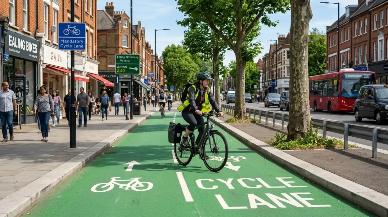
Cycling is becoming an increasingly visible way to travel around Ealing, whether residents are commuting to work, taking children to school, travelling to Ealing Broadway or simply moving between neighbourhoods. However, one of the biggest questions for new and experienced riders is how safe cycling lanes actually are on the borough’s busy main roads.
The answer depends heavily on the type of cycling infrastructure, the road layout, traffic levels and whether a route is physically separated from motor vehicles. Ealing has a mixture of protected cycle tracks, marked cycle lanes, shared routes and roads where cyclists still need to interact directly with general traffic.
Ealing Council has acknowledged that concerns about cycling safety remain a barrier to wider cycling participation. During consultation for its Cycle Network Plan, more than 1,000 residents responded, with many saying there were not enough safe cycling lanes to encourage them to cycle.
For residents and visitors, understanding where protection exists, where gaps remain and how to plan a route can make cycling around Ealing more predictable and comfortable.
What Are Cycling Lanes Like On Ealing Main Roads?
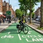
Not every cycle lane in Ealing provides the same level of separation from traffic. Some facilities are physically protected from vehicles, while others use painted markings to indicate space for cyclists.
This distinction matters on busy roads. A marked lane may provide a clearer position for cyclists but does not create the same physical barrier as a segregated cycle track. Turning vehicles, parked cars, loading activity, junctions and buses can also affect how comfortable a route feels.
TfL explains that cycle lanes are separated from general traffic by white solid or dashed lines, with signs and road markings identifying where they operate. On TfL red routes, restrictions can also apply to vehicles entering, stopping or parking in cycle lanes.
For someone deciding whether to cycle along a particular Ealing main road, therefore, the presence of a line painted on the road does not necessarily tell the whole story.
Are Protected Cycle Lanes Safer?
Protected or segregated cycle tracks are designed to provide greater separation between cyclists and motor traffic. This can be particularly important on busy roads where vehicle speeds and traffic volumes make cycling alongside cars, vans and buses less comfortable.
Ealing Council’s approach is to create segregated cycle facilities on main roads where there is sufficient space and funding, particularly where routes provide important connections or existing cycling conditions are difficult.
The council has also identified the need to build a more connected network rather than isolated pieces of cycling infrastructure. Its Cycle Network Plan 2024–2035 describes gaps in the existing network and aims to provide a more strategic basis for future cycle-route delivery.
This means the safety of an individual journey can depend not only on one cycle lane but also on what happens before and after it.
Which Ealing Roads Have Cycling Infrastructure?
Cycling infrastructure can be found across different parts of the borough, although the design and level of separation vary.
Ealing Council highlights the Ruislip Road East cycleway, including a segregated path between Greenford Broadway and Ealing, as well as the A40 cycleway between Wood Lane and Kathleen Avenue.
The wider cycling network also includes routes around Southall, Greenford, Acton, Hanwell and other parts of the borough. TfL’s cycling information currently highlights routes including Acton to Wormwood Scrubs, the Dr Who Trail and the S3 Southall and Greenford route.
For a local journey, this means it can sometimes be worthwhile choosing a slightly different route if it provides more protected or lower-traffic cycling space.
What Is The Situation Around Hanwell And Boston Road?
Boston Road in Hanwell is an example of how Ealing is trying to improve cycling conditions on busy corridors.
Ealing Council’s proposals identified sections where existing cycling infrastructure was limited. Around St Mark’s Primary School, for example, the road had no cycle track, and the council proposed changes including shared pedestrian and cycling space because of the restricted road width.
The council has also announced plans for an extended high-quality protected cycle track on Boston Road in Hanwell. These improvements form part of wider efforts to create safer cycling routes on important roads.
For people living around Hanwell, this demonstrates an important point: cycling conditions are changing, so a route that feels uncomfortable today may have different infrastructure following future highway improvements.
What About Acton And Park Royal?
Acton and Park Royal contain some of Ealing’s important employment and transport corridors, which also creates a need for practical cycling connections.
Ealing Council announced plans for a new protected cycle lane on Acton Lane in Park Royal, alongside proposed two-way cycle tracks on Park Royal Road and Acton Lane. The proposals were intended to improve cycling conditions while also addressing wider traffic-flow and street-design considerations.
For commuters travelling between residential areas and workplaces in Park Royal, protected infrastructure can be particularly useful because these roads may carry significant amounts of commercial and general traffic.
The important consideration is continuity. A protected section is most useful when cyclists can safely reach it and continue safely after it ends.
Are Ealing Main Roads Safe For Beginner Cyclists?
Beginner cyclists may find quieter streets and physically protected routes easier to manage than busy roads with frequent junctions and turning traffic.
Ealing Council recommends several basic road-cycling practices, including looking, signalling and manoeuvring carefully, making eye contact with other road users and keeping an appropriate distance from the kerb and parked vehicles. It also advises cyclists about using the primary position in the centre of a lane where appropriate.
A beginner does not necessarily need to avoid main roads altogether. Instead, route selection can make a substantial difference. A cyclist travelling from Greenford to Ealing Broadway, for example, could investigate whether a route containing segregated infrastructure or quieter connecting streets is more suitable than simply following the busiest road from start to finish.
What Are The Main Safety Risks For Cyclists?
Cycling safety is influenced by more than the cycle lane itself.
Junctions are particularly important because cyclists and vehicles may need to cross one another’s paths. Turning vehicles, parked cars, delivery vehicles and buses can also create temporary obstacles.
The end of a cycle lane can be another challenging point. If protected infrastructure suddenly merges cyclists into general traffic, riders need to understand the road positioning and upcoming junctions.
Poor visibility can also matter during darker mornings and evenings. Wet weather, reduced visibility and busy traffic can make an otherwise familiar route feel different.
These factors explain why simply asking whether an Ealing road “has a cycle lane” is not enough. The quality, continuity and design of the whole route matter.
How Is Ealing Improving Cycling Safety?
Ealing Council has an established objective of expanding cycling infrastructure across the borough. Its earlier transport strategy included an ambition for a robust cycle network connecting important destinations and for roads to become more pleasant and safe for cycling over the longer term.
More recent plans have focused on filling gaps in the network and prioritising difficult cycling conditions. The council’s 2024–2035 Cycle Network Plan provides a strategic framework for future routes, while individual schemes address particular corridors and junctions.
The council also describes Ealing as a “biking borough” and provides cycle training, bike repair advice, cycle parking information and other cycling services.
This combination of infrastructure and rider support is important because safer cycling depends on both the physical street environment and how people use it.
How Can You Check A Safe Cycling Route In Ealing?
Before starting a journey, cyclists can check the available infrastructure rather than automatically selecting the shortest route.
Ealing Council recommends tools including the London Cycling Campaign route planner, Google Maps’ cycling layer and CycleStreets. CycleStreets can also provide photographs of cycling infrastructure along routes, which can help riders understand what to expect before travelling.
TfL also provides a cycling map showing open and proposed routes across London. Its Cycleways are described as high-quality routes intended to link communities, businesses and destinations while helping riders feel safer and more confident.
For a tourist unfamiliar with Ealing, checking the route beforehand can be especially useful. A journey between Ealing Broadway and Acton, for example, may look straightforward on a standard road map but can involve different types of cycling infrastructure depending on the exact streets selected.
What Should Ealing Cyclists Expect In The Future?
Ealing’s cycling network is still developing. The council’s plans show that there are existing gaps and that future schemes are intended to create more connected routes across the borough.
Recent proposals for Boston Road, Acton Lane and Park Royal Road illustrate the direction of travel: more protected infrastructure on important roads where space and funding allow.
At the same time, residents should recognise that planned infrastructure does not mean every major road will immediately have a fully segregated cycle track. Delivery depends on design, funding, consultation and other highway considerations.
For cyclists, this means checking current route information rather than relying entirely on older maps or assumptions about where protected lanes exist.
So, How Safe Are Cycling Lanes On Ealing Main Roads?
The safety experience varies considerably between different Ealing roads and different types of cycle infrastructure. Protected and segregated routes can provide greater separation from motor traffic, while painted lanes and mixed-traffic sections require cyclists to interact more closely with other road users.
Ealing Council’s own consultation evidence shows that perceived safety is an important barrier to cycling, while its current plans are focused on improving protection and closing gaps in the network.
For residents, commuters and tourists, the most practical approach is to look at the complete journey rather than one section of road. Check whether the route is protected, identify difficult junctions, look for quieter alternatives and use current TfL and Ealing Council route information before setting off.
Ealing is continuing to develop its cycling network, so the safest and most comfortable route can change as new schemes are delivered.
Frequently Asked Questions
Are there protected cycle lanes in Ealing?
Yes. Ealing has segregated and protected cycling facilities on parts of its network, including infrastructure around Ruislip Road East, while further protected routes are planned or being developed on corridors such as Boston Road and Acton Lane.
Is cycling safe on Ealing’s main roads?
Safety varies by road, junction and infrastructure design. Protected cycle tracks provide greater separation from traffic, while painted lanes and mixed-traffic roads require more interaction with other vehicles.
Which areas of Ealing are good for cycling?
Ealing has cycling routes around areas including Greenford, Southall, Hanwell and Acton. TfL also provides recommended routes such as S3 Southall and Greenford and Acton to Wormwood Scrubs.
Are Ealing cycle lanes suitable for beginners?
Some protected and lower-traffic routes can be easier for beginners, but cyclists should assess the complete journey, including junctions and sections where dedicated infrastructure ends. Ealing Council also provides cycling advice and training resources.
What are the biggest risks when cycling on Ealing roads?
Common issues can include busy junctions, turning vehicles, parked or loading vehicles, gaps between cycle facilities and sections where cyclists must share road space with general traffic.
Can I find Ealing cycling routes online?
Yes. TfL provides a cycling map and route information, while Ealing Council recommends resources including the London Cycling Campaign route planner, Google Maps cycling directions and CycleStreets.
Is Ealing Council planning more cycle lanes?
Yes. Ealing’s Cycle Network Plan 2024–2035 sets out a strategic approach to developing the borough’s cycling network, while specific proposals include protected facilities on Boston Road, Acton Lane and Park Royal Road.