
Ealing is often associated with elegant Victorian streets, leafy parks, busy high streets and well-known landmarks such as Pitzhanger Manor & Gallery. Yet beyond its familiar attractions lies another layer of local history: old boundaries, parish divisions, historic roads, unusual stones, former estates and overlooked corners that reveal how the borough developed over centuries.
For anyone interested in boundary markers and forgotten corners in Ealing, exploring these details can transform an ordinary walk into a journey through the area’s past. A modest boundary stone, an old wall or an unusual change in street layout can sometimes tell a story about land ownership, parish administration, agriculture, transport or the gradual expansion of London.
These features may not always appear on conventional tourist itineraries, but they are particularly interesting for residents and visitors who enjoy discovering places through observation. Ealing’s history becomes more understandable when its streets, parks and neighbourhoods are viewed as parts of a much older landscape.
Why Historic Boundaries Matter in Ealing
Modern borough boundaries can make historic divisions difficult to imagine. Today, Ealing is a London borough with neighbourhoods including Ealing Broadway, Acton, Hanwell, Northfields, Southall, Greenford, Perivale and Northolt. Historically, however, these places had their own identities, parishes, manors, estates and rural settlements.
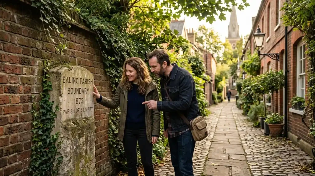
Boundaries were important because they determined responsibilities and ownership. Parish boundaries could influence where people paid rates, received poor relief or attended church, while estate boundaries separated land controlled by different owners.
The physical evidence of these divisions has often disappeared as London expanded. Roads were widened, housing estates were built, farmland was developed and old land parcels were reorganised. Yet traces can remain in unexpected places.
An old lane following an unusually irregular route, a wall separating two properties or a sudden change in building style may reflect an earlier boundary or field pattern.
Ealing’s Transition From Rural Landscape to London Borough
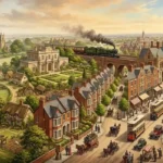
Understanding forgotten corners requires some knowledge of Ealing’s transformation. Much of the area was once rural, with agricultural fields, orchards, meadows and country estates surrounding established villages.
Ealing developed rapidly during the nineteenth century as transport links improved. The arrival and expansion of railways encouraged housing development and connected the area more closely with central London.
The result was a layered landscape. Older roads and property boundaries were sometimes retained while new streets were constructed around them. This explains why some parts of Ealing can appear highly planned while others contain surprisingly winding routes.
When walking through the borough, these contrasts are clues. A modern-looking residential street may follow the edge of a much older field. A narrow lane may once have been a rural track. A large park may preserve part of an estate that existed before surrounding housing.
Parish Boundaries and Local Identity
Parishes played a significant role in the historical development of places such as Ealing, Hanwell, Acton, Greenford and Northolt. These communities developed around churches, manor houses, farms and local roads, creating identities that remain visible today.
St Mary’s Church in Hanwell, for example, provides an important historical reference point within the neighbourhood. The area surrounding the church reflects Hanwell’s long development from a rural settlement into a densely populated part of West London.
Acton similarly developed from a village outside London into a substantial urban district. Its historic centre and surviving older buildings provide clues about the period before modern development transformed the area.
When exploring Ealing’s neighbourhoods, it is therefore useful to think about the historic parish rather than only the present-day postcode. Modern administrative boundaries do not always correspond with the older geography of the area.
Boundary Stones and Other Physical Markers
Historic boundary markers can take many forms. Some are clearly identifiable stones or plaques, while others are less obvious.
A boundary stone might contain initials, dates, coats of arms or abbreviations indicating the authority or estate responsible for the boundary. Some markers were positioned beside roads, streams or walls so that the boundary could be recognised without relying on maps.
Other markers may have disappeared entirely, leaving only documentary evidence. In such cases, old maps can become particularly useful.
The London County Council’s historic maps, Ordnance Survey maps and digitised local archives can help researchers compare modern streets with earlier landscapes. A road that appears ordinary today may have existed for centuries, while another street may occupy land that was once part of a field or estate.
For amateur local historians, this comparison can be more rewarding than simply searching for famous monuments.
Forgotten Corners Around Ealing Broadway
Ealing Broadway is now one of the borough’s busiest commercial centres, but its historic development is still visible if you look carefully.
The area around Ealing Green and Pitzhanger Manor & Gallery provides one of the clearest examples. Pitzhanger was originally part of the estate of architect Sir John Soane, and the surviving manor and grounds preserve a sense of the landscape that existed before modern urban expansion.
Nearby streets contain layers from different periods. Georgian and Victorian influences sit alongside twentieth-century commercial development and modern apartment buildings.
A visitor interested in forgotten details should avoid rushing directly between major attractions. Instead, look at building lines, walls, older entrances and changes in pavement or street alignment.
These small observations can reveal how the town centre evolved.
Exploring Old Lanes Around Hanwell
Hanwell is particularly rewarding for people interested in overlooked historic landscapes. The neighbourhood developed around the River Brent, the Grand Junction Canal and old transport routes, creating a landscape where water, industry, agriculture and housing became closely connected.
The Wharncliffe Viaduct is one of the most recognisable historic structures in Hanwell. Designed by Isambard Kingdom Brunel, it carried the Great Western Railway across the Brent Valley and represents the major transformation brought by nineteenth-century railway construction.
But the viaduct is only one part of the story. Walking around Hanwell can reveal older routes, canal-side spaces, walls and buildings that reflect different phases of development.
The contrast between railway infrastructure and older village features makes the neighbourhood especially interesting for anyone studying how transport changed local geography.
Greenford and Perivale: Traces of the Older Landscape
Greenford and Perivale contain some of the most useful examples of Ealing’s rural and medieval past. Perivale’s historic church, St Mary’s, stands as a reminder of the area’s earlier settlement pattern.
Perivale was once dominated by agricultural land, and the church’s survival provides a strong connection with that landscape. Nearby open spaces and the River Brent corridor help visitors understand why settlement developed where it did.
Greenford also contains traces of its earlier identity. The area grew from a rural village into a major suburban district, but older roads, buildings and open spaces continue to provide clues.
For visitors, this means that a walk through Greenford or Perivale can be approached as a historical landscape rather than simply a suburban journey.
Northolt’s Historic Landscape
Northolt is another neighbourhood where historic geography remains important. Its long association with agriculture, the church and surrounding open land makes it different from the more densely urbanised parts of Ealing.
St Mary’s Church in Northolt is one of the area’s most significant historic landmarks. The church and surrounding landscape help demonstrate the long continuity of settlement.
Northolt’s open spaces also provide opportunities to understand the relationship between the village and its former agricultural surroundings. The survival of green areas is particularly valuable because much of London’s historic countryside has been built over.
A visitor walking through Northolt can therefore look beyond individual buildings and consider the larger landscape: where roads run, where open land survives and how modern housing relates to older settlement patterns.
The Role of Walls, Hedges and Estate Boundaries
Not every historic boundary has a stone marker. Walls, hedges, ditches and tree lines could all function as practical divisions between properties or fields.
Some surviving walls in Ealing may have originally marked estate or property boundaries. Even where their original purpose is uncertain, their position can provide clues when compared with historic maps.
Hedges are especially interesting because traditional field boundaries often survived long after the agricultural land disappeared. A line of mature trees or unusually dense vegetation can sometimes correspond with an old field edge.
These features are easy to overlook because they do not necessarily look historic. Their value becomes apparent when combined with documentary evidence.
How to Research Ealing’s Forgotten Places
Anyone wanting to investigate historic boundaries should begin with reliable local sources. Ealing Council’s local history resources, Ealing Local History Centre and historic map collections can provide useful information about the borough’s development.
Old Ordnance Survey maps are particularly valuable because they show roads, buildings, waterways, field boundaries and landmarks in considerable detail.
The best approach is to compare at least two periods. Find a modern map and then look at the same location on a nineteenth- or early twentieth-century map. Ask what has changed and what has remained.
If a modern road follows an old field boundary, that may explain an unusual curve. If two neighbourhoods meet along a straight line, investigate whether the line corresponds with an earlier parish, estate or property division.
This method turns a simple walk into a form of local historical research.
A Practical Walking Approach for Visitors
You do not need specialist equipment to explore Ealing’s historic corners. A phone with mapping software, comfortable shoes and a notebook are usually enough.
Choose one neighbourhood rather than trying to cover the whole borough in a single day. Ealing Broadway and Ealing Green work well for an introduction, while Hanwell, Perivale, Greenford and Northolt provide different historical perspectives.
Take photographs of unusual walls, road signs, old buildings and changes in street layout. Later, compare them with historic maps or local history sources.
Always remain respectful when exploring residential areas. A historic feature may sit on private property or beside someone’s home. Public footpaths and roads should be used, and visitors should never climb walls or enter restricted land simply to inspect a suspected boundary marker.
Why Forgotten Corners Matter Today
Historic features do not have to be grand monuments to be valuable. Small traces can provide important evidence about how communities lived and how the landscape changed.
A forgotten boundary can reveal the former extent of a parish. An old lane can show how people travelled before modern roads. A surviving wall can preserve the outline of an estate, while a mature hedge can indicate a former field division.
These details help residents develop a stronger sense of place. They also offer tourists a different way to experience Ealing, away from the busiest attractions.
Local history becomes more engaging when it is connected to the streets people actually walk along.
Discover Ealing One Historic Detail at a Time
Exploring boundary markers and forgotten corners in Ealing is ultimately about learning to read the landscape. The borough contains layers of rural history, parish organisation, estate ownership, railway development, industrial growth and suburban expansion.
Places such as Ealing Green, Hanwell, Perivale, Greenford and Northolt each reveal different parts of this story. Some clues are obvious, while others require old maps, careful observation and a little imagination.
The next time you walk through Ealing, look beyond the obvious landmarks. Notice the road that bends unexpectedly, the wall that seems older than the houses beside it, the church standing within modern development or the strip of green space that appears strangely out of place.
These overlooked details may be the surviving fragments of an older Ealing.
Frequently Asked Questions
What are historic boundary markers?
Historic boundary markers are physical features used to indicate the division between parishes, estates, properties, districts or other areas. They can include stones, posts, walls, ditches, hedges, plaques and other identifiable features.
Where can I explore Ealing’s historic landscape?
Ealing Green, Hanwell, Perivale, Greenford and Northolt are particularly interesting areas for exploring historic landscapes. Each contains surviving buildings, roads, churches, parks or waterways connected with earlier phases of local development.
Are there boundary stones in Ealing?
Historic boundary markers may survive in different forms, although not every suspected marker is officially documented or publicly accessible. Local archives and historic maps are useful for verifying the history of individual features.
Which old maps are useful for researching Ealing?
Ordnance Survey maps are particularly helpful because they show historic roads, buildings, fields, waterways and boundaries. Comparing older maps with modern mapping can reveal how Ealing’s neighbourhoods changed.
Why does Ealing have so many different historic neighbourhoods?
Modern Ealing developed from several older villages, parishes and settlements. Areas such as Acton, Hanwell, Greenford, Northolt and Perivale had distinct histories before becoming part of the modern London borough.
Can tourists explore Ealing’s historic boundaries on foot?
Yes. Many historic clues can be observed from public roads, footpaths, parks and other accessible places. A walking route combining historic buildings, old roads, parks and waterways can provide an engaging introduction to Ealing’s past.
How can I find out more about Ealing’s local history?
The Ealing Local History Centre, Ealing Council resources, historic maps, archives and local history publications are useful starting points. Comparing documentary evidence with what you see during a neighbourhood walk can make research much more rewarding.