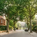

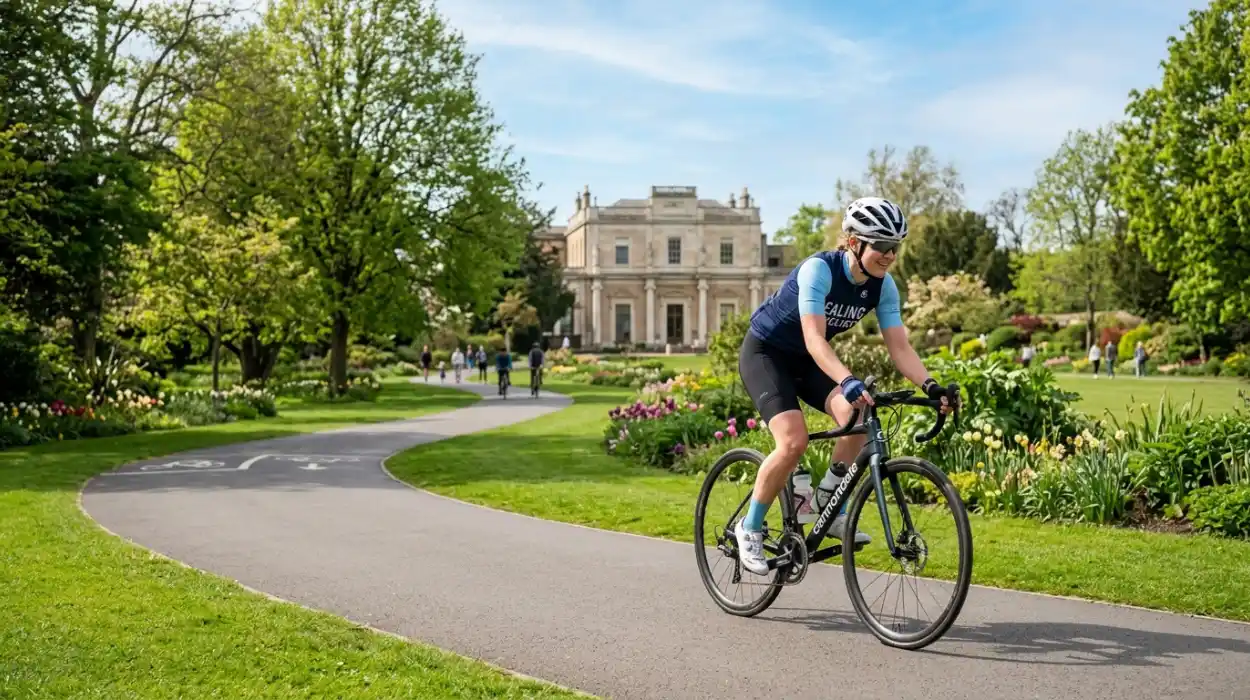
Ealing is one of West London’s greener boroughs, making it an appealing place to explore by bicycle. Its combination of parks, open spaces, residential streets, canals and connections to neighbouring areas creates opportunities for both everyday cycling and leisurely rides.
For someone searching for cycle routes in Ealing, there is no single route that suits everyone. A parent cycling with children may prefer a quieter park connection, while a commuter might prioritise a direct route with dedicated cycling infrastructure. Experienced riders may be comfortable using busier roads to travel further across West London, whereas beginners may want to start with shorter rides through green spaces.
Ealing Council’s current Cycle Network Plan 2024–2035 aims to create a more connected network of safer cycle lanes, paths and routes across the borough. The plan was developed following consultation with more than 1,000 residents and focuses on improving existing connections as well as developing new ones.
This guide explores some of the best places to cycle in and around Ealing, what different routes are suitable for, and how to plan a safer and more enjoyable ride.
Why Is Ealing Good for Cycling?
Ealing combines urban neighbourhoods with an unusually large amount of accessible green space. The borough contains parks, recreation grounds, countryside areas and waterways, creating different environments for cyclists.
Some routes are useful for commuting, while others are better suited to weekend rides, family outings or gentle exercise. The Brent River Park, for example, stretches along approximately 7km of the Brent Valley and includes parts of Perivale, Greenford and Hanwell. Cycle paths run through parts of the park, creating opportunities to combine cycling with time in nature.
The borough is also developing a more joined-up cycling network. Ealing Council categorises planned routes as Core, Other Key, Neighbourhood and Green routes, with Green routes generally following canals or passing through parks and open spaces.
Cycling Along the Ruislip Road East Cycleway
The Ruislip Road East cycleway is one of the routes worth knowing about when exploring cycle routes in Ealing. Ealing Council identifies a segregated cycle path running from Greenford Broadway towards Ealing along Ruislip Road East.
Its separation from general traffic can make this type of infrastructure particularly appealing to cyclists who do not feel comfortable sharing busy roads.
The route is also useful for connecting residential areas with local destinations. Instead of viewing a cycleway simply as somewhere to exercise, residents can use it for practical journeys such as visiting shops, connecting with other routes or travelling between neighbourhoods.
As with any urban route, conditions can vary, so cyclists should remain alert at junctions, crossings and points where infrastructure changes.
A40 Cycleway
Another important piece of cycling infrastructure is the A40 cycleway. Ealing Council describes the cycleway as running from Wood Lane to Kathleen Avenue.
For experienced commuters, routes alongside major transport corridors can provide useful connections across West London. However, cycling beside a major road may feel very different from riding through a park or residential street.
If you are new to cycling, consider practising on quieter routes before attempting longer journeys involving major junctions.
The A40 corridor can be particularly relevant to people travelling between Ealing and neighbouring areas, making it more useful as part of a wider journey than as a recreational cycle route.
Brent River Park and the Brent Valley
For cyclists who prefer greenery, the Brent River Park is one of the most interesting areas to explore.
The park follows the Brent Valley through Perivale, Greenford and Hanwell. It covers around 400 hectares of open space and includes parks, sports grounds, nature areas and other green spaces. Parts of the park have cycle paths, although not every path should automatically be treated as a dedicated cycleway.
The landscape provides a welcome contrast to busy urban roads. A cyclist can move between green spaces while experiencing a very different side of Ealing from the high streets and town centres.
It is particularly suitable for recreational rides, photography stops and gentle weekend exploration.
Pitshanger Park and Perivale
Pitshanger Park is another strong choice for cyclists who want a green environment without leaving Ealing’s built-up areas.
The park forms part of the Brent River Park and contains cycle paths connecting towards St Mary’s, Perivale and Gurnell. Ealing Council lists access points from Bellevue Road, Scotch Common, Argyle Road, Perivale Lane and Meadvale Road.
This makes the area useful as part of a longer cycling journey rather than simply a destination.
Families may appreciate the combination of open space, sports facilities and nearby cycle connections. Riders can also use the surrounding paths to explore parts of Perivale and the wider Brent Valley.
Because parks can have shared pedestrian and cycling areas, slower speeds and consideration for walkers are important.
Northolt and Greenford Countryside Park
The Northolt and Greenford Countryside Park provides another excellent option for cyclists seeking open landscapes.
The park connects approximately 110 hectares of open space in the north-west of Ealing. It includes areas around Greenford and Northolt and is crossed by both the A40 and Grand Union Canal. Ealing Council specifically notes that there are good walking and cycling routes throughout the countryside park.
The area is particularly interesting because it combines countryside scenery with urban connectivity.
For someone living in Greenford or Northolt, this can be a practical place for a short recreational ride. More experienced cyclists can also incorporate the area into longer journeys across west London.
Cycling Around Horsenden Hill
Horsenden Hill is one of the recognisable green spaces around Greenford and Perivale. Its surrounding countryside provides opportunities for cyclists looking for a more natural setting.
However, riders should distinguish between cycle-friendly paths and walking-only paths. A route appearing on a walking map is not necessarily a permitted cycle route.
This is particularly important in natural areas where paths may be narrow, muddy or shared with pedestrians. Choosing suitable routes and checking local signage will make the experience safer for everyone.
For leisure cycling, the wider Greenford and Perivale countryside can be combined with nearby parks and cycle connections to create a longer outing.
Cycling Through Hanwell
Hanwell is another useful area for exploring Ealing by bike. Its location alongside the Brent Valley and its connections towards Southall, Ealing and neighbouring areas make it an interesting starting point for longer rides.
The area is particularly appealing to cyclists who enjoy combining green spaces with urban exploration. You can ride through residential streets and parkland before continuing towards other parts of the borough.
Ealing Council’s cycling plans include improvements intended to make routes around the borough safer and better connected. Proposed improvements have included a protected cycle track on Boston Road in Hanwell.
Because infrastructure projects can change over time, cyclists should check current conditions before setting out.
Grand Union Canal Cycling
The Grand Union Canal is another important feature when considering cycling routes in Ealing.
Canal-side routes can provide a quieter alternative to busy roads and are particularly attractive for leisure cycling. The canal also connects different green spaces and neighbourhoods, making it useful as part of a longer route.
However, canal towpaths are shared spaces rather than race tracks. Walkers, anglers, families and other cyclists may all be using the same path.
A considerate cyclist should slow down when approaching pedestrians, give an audible warning where appropriate and allow plenty of space when passing.
Cycling Around Southall and Norwood Green
Southall and Norwood Green offer additional opportunities for cyclists, particularly for residents in the southern part of the borough.
The area contains connections between parks, residential streets and canal-side spaces. Ealing Council’s wider walking and green-space resources also identify routes around Southall, including areas such as Brent Meadow, Norwood Green and Spikes Bridge Park.
Cyclists should remember that walking routes are not automatically cycling routes. Where a path is pedestrian-only, riders should dismount and continue on foot.
For a longer ride, the southern part of Ealing can be combined with neighbouring areas, creating an itinerary that includes parks, canals and local neighbourhoods.
Cycling Through Ealing’s Parks
One of the simplest ways to enjoy cycling in Ealing is to connect several parks rather than following one fixed route.
Pitshanger Park, Perivale Park, Walpole Park, Lammas Park, Elthorne Park and other open spaces can provide natural breaks during a longer ride.
The benefit of this approach is flexibility. If you are tired, you can stop at a park. If the weather changes, you can shorten your route. If you are riding with children, you can choose a destination with open space and facilities.
Ealing Council’s published local walking resources cover numerous parks and open spaces across Ealing, Acton, Greenford, Northolt, Perivale and Southall.
Best Cycle Routes for Beginners
Beginners should prioritise routes that allow them to build confidence gradually.
Green spaces, quieter residential streets and segregated cycleways can be more comfortable starting points than heavily trafficked roads. A short loop around a park can help a new cyclist practise braking, signalling, turning and judging distances.
Ealing Council recommends that cyclists ride confidently and safely, including looking, signalling and manoeuvring appropriately. It also advises cyclists to maintain space from kerbs and parked cars and to use the primary position when appropriate.
A beginner does not need to complete a long-distance route on the first attempt. A 30-minute local ride can be just as useful as a two-hour journey.
Best Cycle Routes for Families
Family cycling requires a different approach from commuting.
Parents should consider route surface, traffic, crossings, stopping points and the cycling ability of children. Parks and green routes can be preferable because they offer opportunities to pause and avoid continuous exposure to heavy traffic.
Pitshanger Park and parts of the Brent River Park can be useful areas to explore, although cyclists should remain aware of pedestrians and check whether particular paths permit cycling.
For younger children, a short out-and-back route may be easier than a large circular journey. Older children who are confident cyclists can gradually move towards longer routes connecting several neighbourhoods.
Best Options for Commuting
For commuting, directness and predictable journey times usually matter more than scenery.
The Ruislip Road East cycleway and A40 cycleway are particularly relevant to Ealing’s strategic cycling network. The council’s wider Cycle Network Plan aims to improve connectivity and create a more coherent network across the borough.
Commuters should plan their route before travelling, particularly if they are crossing busy junctions or combining dedicated cycleways with ordinary roads.
A useful strategy is to test the route at the weekend first. This allows you to identify difficult junctions, crossings, bike parking locations and alternative streets before using it during a busy weekday commute.
How to Plan Cycle Routes in Ealing
Good planning can make a significant difference to your cycling experience.
Ealing Council recommends using tools such as the London Cycling Campaign route planner, Google Maps’ cycling layer and CycleStreets to plan journeys. CycleStreets can also provide information about cycling infrastructure along a proposed route.
Before leaving, check the route distance and estimated cycling time. Look for dedicated cycleways where possible, but also check whether a proposed path is shared with pedestrians.
Weather matters too. A route that feels comfortable in dry conditions can become muddy or slippery after heavy rain, particularly around parks and unpaved areas.
Cycling Safely in Ealing
Safety should be part of every cycling plan.
Wear appropriate clothing and consider using a properly fitted helmet. Make sure your bicycle’s brakes, tyres, lights and gears are working before a longer journey.
On roads, remain aware of parked vehicles and doors that may suddenly open. At junctions, make your intentions clear and avoid riding unpredictably.
Ealing Council specifically advises cyclists to look, signal and manoeuvre safely, maintain appropriate distance from kerbs and parked cars, and use the primary position when necessary.
On shared paths, pedestrians have just as much right to enjoy the space. Reduce your speed and give others plenty of room.
The Future of Cycling in Ealing
Cycling infrastructure in Ealing is continuing to evolve.
The Ealing Cycle Network Plan 2024–2035 sets out the council’s ambition to develop a connected network of safer cycling routes. The plan includes different types of routes, from major Core routes to neighbourhood and green connections.
The consultation process showed strong interest from local residents in improving existing routes and making cycling feel safer.
This matters because a cycle route is most useful when it connects to another route. A protected section that ends abruptly can still leave cyclists facing a difficult road environment. A joined-up network, by contrast, can make cycling practical for everyday journeys.
The best cycle routes in Ealing are not limited to one road or one park. The borough offers a mixture of segregated cycleways, green routes, canal-side connections, quiet streets and open spaces.
For green scenery, Brent River Park, Pitshanger Park and the Northolt and Greenford Countryside Park are excellent areas to explore. For practical journeys, routes such as the Ruislip Road East cycleway and A40 cycleway are important parts of the borough’s cycling infrastructure.
The best route depends on your purpose. Beginners may prefer short and quieter rides, families may prioritise parks and shared green spaces, while commuters may want direct cycleways connecting residential areas with workplaces and transport hubs.
Before setting off, check the current route conditions, follow local signage and use a route planner. With sensible preparation, cycling can be one of the most enjoyable ways to discover Ealing’s parks, neighbourhoods and greener corners.
Frequently Asked Questions
What are the best cycle routes in Ealing?
Popular areas include the Ruislip Road East cycleway, A40 cycleway, Brent River Park, Pitshanger Park and the Northolt and Greenford Countryside Park. Each offers a different cycling experience.
Is Ealing good for beginner cyclists?
Yes, particularly if beginners start with quieter roads, green routes and suitable cycleways. New cyclists should build confidence gradually and check whether paths permit cycling before using them.
Can you cycle through Brent River Park?
Cycle paths run through parts of Brent River Park, but not every path in the park is necessarily a cycling route. Cyclists should follow local signs and be considerate around pedestrians.
Is there a cycleway along Ruislip Road East?
Yes. Ealing Council identifies a segregated cycleway along Ruislip Road East connecting Greenford Broadway towards Ealing.
Can families cycle in Ealing?
Yes. Parks and quieter green connections can be suitable for family cycling, provided cyclists choose age-appropriate routes and check local restrictions. Pitshanger Park and parts of the Brent Valley are useful areas to investigate.
How can I plan a cycling route in Ealing?
Ealing Council recommends tools including the London Cycling Campaign route planner, Google Maps’ cycling layer and CycleStreets. These can help you identify cycleways, quieter roads and other cycling infrastructure.
Is Ealing improving its cycling network?
Yes. Ealing’s Cycle Network Plan 2024–2035 aims to create a more coherent and connected network of safe cycling routes, with improvements planned across different parts of the borough.